Sunset at the Pinnacles
As I start this blog it is difficult to know where to begin sharing. One of the most beautiful areas around the lake is the Pinnacles. This collection of Tufa formations, sand and rock is unique and very photographic. But is it really the most beautiful, unique and interesting location? I don't think so. So let's begin with a quick journey around the Reservation before we explore PhotoQuests of specific areas.
Pyramid Lake is a terminal desert lake that lies at end of the Truckee River. The lake is in jeporady, as many of the worlds terminal lakes are. Water diversions, droughts and upstream pollution all threaten this ancient, natural body of water. The Tribe has been aggressively fighting for the lake's survival but western water fights are not easy battles to win.
Pelicans on the Truckee River
The reality is that the lake has no water rights, it is up to mother nature to produce abundant moisture in the Sierra Nevada's and surrounding mountains. This moisture feeds Lake Tahoe, the headwaters of the Truckee River, and the many streams that empty into Pyramid. I will let scientists theorize on the effects that global warming might have on this ecosystem. One thing is for certain, Pyramid Lake's water level will continue to fluctuate. We probably won't see it shrink to a puddle in our lifetime and we probably won't see it overflow to the surrounding playas, but those events have happened before and are sure to repeat. The power of Mother Nature usurps water wars, dams and diversions.
On the east shore of the lake lies the "Pyramid". This tufa formation is over 300 feet tall and, depending upon the level of the lake, is and island or is connected to land by a narrow strip of sand. The rock formation and the lake were named by the early white explorer, John Fremont. Tufa rocks are composed primarily of Calcium Carbonate deposits that formed underwater. A great article about Pyramid Lake tufa and the climatic and geological history of the area can be found on the Tribe's website at: http://www.plpt.nsn.us/geology/index.html .
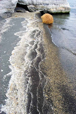
East Shore Shapes
The east shore of the lake is a great place to explore and photograph. Along with the Pyramid, there are a number of other tufa formations and some interesting shoreline features. late afternoon sunsets are best as the high mountains to the east limit early sunrise shooting possibilities. Be sure to explore the Pyramid rock area and beaches to the north. A dirt road with shore access leads north for about 10 miles before ending at Hells Kitchen.
The west shore of the lake is the most accessible. There are several beaches with easy car access and many area where tufa formations, wildlife and landscapes are just waiting to be photographed. A paved road follows most of the east shore but it turns to dirt about 9 miles north of Sutcliffe.


1 comment:
Steve,
Great pictures. My wife and I stayed on the reservation for four days in early October and loved the place. We spent two days with the folks with Eagle Eye Charters--one on the lake and one on land, and part of another day with a fellow named Tex. We took probably a couple thousand photos. I just wish it weren't 1400 miles away.
Thanks for posting. Hope to see more.
Joe Trent
Lubbock, Texas
Post a Comment